

State Assam, India
District Kamrup Metropolitan
Location Southern bank of the Brahmaputra
Historic association Pragjyotishpur and Kamarupa
Name Traditionally linked to guwa (areca nut) and haat (market)
Role Assam's largest urban centre and a major gateway to Northeast India
Capital area Dispur, seat of the Government of Assam
Landscape River, hills, forests and wetlands
Major landmark Kamakhya Temple
Important wetland Deepor Beel, a Ramsar site
Known for Trade, education, culture and regional connectivity
Contents
- A city shaped by the Brahmaputra
- Pragjyotishpur, Kamarupa and historical Guwahati
- Where the name Guwahati comes from
- Kamakhya and the city's religious landscape
- From river town to metropolitan centre
- A city of institutions
- Deepor Beel and the environmental question
- A city under pressure
- Why Guwahati matters
- Guwahati at a glance
Guwahati is Assam's largest urban centre, but it has never been a city that grew on a flat, open plain. The Brahmaputra runs along its northern edge. Hills rise through and around the city. Wetlands, forests and old water bodies remain part of its geography even as roads, apartment blocks and commercial areas continue to expand.
That geography explains much about Guwahati: its history as a riverine settlement, its importance as a gateway to the Northeast, its recurring problems with flooding and waterlogging, and the pressure created by rapid urban growth.
Today, Guwahati is the principal commercial and transport centre of Assam and the most important metropolitan centre in Northeast India. State planning documents describe its importance in terms of population, connectivity and strategic location, while also recognising the challenges created by rapid urbanisation.
But Guwahati is not simply a modern city that happens to have an ancient past. Its older religious and political landscapes remain visible in the places around which the city grew.
A city shaped by the Brahmaputra
The Brahmaputra is central to Guwahati's identity. The river flows along the city, while the built-up area extends southwards across an undulating landscape broken by hills, streams and low-lying wetlands.
According to Guwahati Smart City Limited, the city forms part of the Indo-Burma Biodiversity Hotspot and is surrounded by eighteen hills. It also contains reserve forests, wildlife sanctuaries and the Deepor Beel wetland within the wider urban landscape.
This unusual setting gives Guwahati much of its character. It also creates difficult planning conditions.
Natural drainage has been altered by construction and the growth of roads and settlements. Low-lying areas remain vulnerable to waterlogging during heavy rain. Hill cutting and construction on unstable slopes have added to the risk of landslides in several parts of the city. Rapid development has made the relationship between the city's natural landscape and its built environment increasingly difficult to manage.
Guwahati's geography is therefore not background scenery. It remains one of the central facts of life in the city.
Pragjyotishpur, Kamarupa and historical Guwahati
Guwahati is associated with the ancient names Pragjyotishpur and Kamarupa, although history and mythology are often mixed too freely when describing the city's past.
The name Pragjyotishpur appears in ancient literary and mythological traditions, while the wider region later became associated with the Kamarupa kingdom. The present-day city occupies an area with a long political and religious history, but not every story attached to ancient Guwahati can be treated as a documented historical event.
Government accounts of Kamrup Metropolitan district continue to identify Pragjyotishpur as an earlier name associated with the region. They also note Guwahati's later importance under the Ahom administration, when it became associated with the office of the Borphukan, the civil and military authority appointed by the Ahom king.
The city's strategic position on the Brahmaputra made it important to competing powers. Guwahati stood near the frontier between the Ahom kingdom and territories controlled at different times by the Koch and Mughal powers. Control of the river and surrounding hills was not merely symbolic; it carried military and commercial importance.
The city changed significantly under British rule and continued to grow after Independence. Its role expanded further when Dispur became the seat of the Assam government.
Where the name Guwahati comes from
The most widely repeated explanation is that Guwahati comes from the Assamese words guwa, meaning areca nut, and haat, meaning market.
Government sources for Kamrup Metropolitan district also give this explanation.
The traditional name points to the city's older role as a place of trade and exchange. Guwahati's position beside the Brahmaputra and its connections with the surrounding hills helped make it an important meeting point long before it developed into the metropolitan centre seen today.
Kamakhya and the city's religious landscape
No account of Guwahati is complete without Kamakhya.
Located on Nilachal Hill, the Kamakhya Temple is one of India's most important Shakti shrines and a major centre of pilgrimage. The temple also represents the depth of Guwahati's religious history and the continuing importance of the city beyond its commercial and administrative role.
The Kamrup Metropolitan district administration describes Kamakhya as an important centre for tantric worship and notes that the present temple was reconstructed in the sixteenth century after an earlier structure was destroyed.
Kamakhya is only one part of a much wider religious landscape. Umananda Temple, on Peacock Island in the Brahmaputra, Sukreswar Temple, Navagraha Temple, Basistha Ashram and other sites give the city a concentration of religious and historical places rarely found within one urban area.
These places are still part of everyday Guwahati. Pilgrimage buses, tourists, local worshippers and ordinary commuters move through the same city.
From river town to metropolitan centre
Modern Guwahati expanded through trade, administration, education and transport.
It became Assam's principal urban gateway because of its location. Roads from western and lower Assam meet routes leading towards the other northeastern states. The city is also a major rail centre and home to Lokpriya Gopinath Bordoloi International Airport.
Dispur, the capital of Assam, lies within the wider Guwahati urban area. This gives the city a concentration of political, commercial and institutional activity that continues to attract people from across Assam and the Northeast.
Planning documents have recognised Guwahati as the region's most important city for population, transport connectivity and strategic location. The same documents also make clear that the pace of growth has created serious demands on land, drainage, transport and public infrastructure.
The older image of Guwahati as a relatively compact river town no longer applies. It is now a sprawling urban region whose growth has extended across former agricultural land, wetlands and hill slopes.
A city of institutions
Guwahati's influence also comes from its institutions.
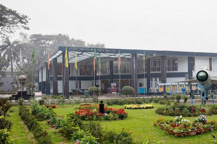
The city is home to Gauhati University, Cotton University, IIT Guwahati, the Assam High Court, the Indian Institute of Information Technology Guwahati, the Sankardev Kalakshetra, the Assam State Museum and several major hospitals, research centres and cultural institutions.
Students, patients, job seekers and visitors from across Assam regularly travel to Guwahati because many of the state's most important institutions are concentrated here.
This has helped create a city with several identities at once. It is a capital-region city, an education centre, a trading hub and a transport gateway. It is also a place where rapid development sits beside old neighbourhoods, temples, markets and riverfront settlements.
Deepor Beel and the environmental question
One of the clearest examples of Guwahati's environmental importance is Deepor Beel, also spelt Dipor Beel.
Located southwest of the city, it is a major freshwater wetland and a Ramsar site. The Assam government's Guwahati Smart City Limited describes it as a former channel of the Brahmaputra with significant biological importance. It also functions as a major natural stormwater storage basin for Guwahati and supports resident and migratory birds, along with wildlife movement from surrounding forests.
Deepor Beel demonstrates why Guwahati's environmental problems cannot be separated from urban planning.
Wetlands store water. Forests and hills affect drainage and slope stability. Natural channels carry runoff. When these systems are weakened or altered, the consequences are felt elsewhere in the city.
Guwahati also has reserve forests and wildlife areas within or close to its expanding urban limits. According to official biodiversity information, the wider city landscape includes eight reserve forests, Deepor Beel Wildlife Sanctuary and Amchang Wildlife Sanctuary.
A city under pressure
Guwahati's growth has brought opportunity, but it has also exposed weaknesses that have accumulated over decades.
Traffic congestion remains a daily problem. Heavy rain can overwhelm drainage in several localities. Construction and hill cutting have increased concern over slope stability. Wetlands and water bodies face pressure from surrounding development. Waste management and the capacity of civic infrastructure remain continuing challenges for a city growing faster than many of its systems.
There is no simple solution because Guwahati's problems are connected.
A drainage problem can begin with the loss of natural water channels. A landslide risk can be linked to slope modification and construction. Traffic reflects the spread of the city and dependence on a limited road network. Pressure on Deepor Beel is also pressure on an ecological system that performs an important function for the wider city.
The future of Guwahati will depend partly on whether its growth can work with its landscape rather than continuously trying to overpower it.
Why Guwahati matters
For Assam, Guwahati is where many journeys begin.
It is the arrival point for visitors travelling into the Northeast and the departure point for people heading across India and beyond. It is where state institutions, businesses, universities and cultural organisations are concentrated. It is also one of the few Indian cities where a major river, forested hills, wildlife movement, ancient temples and a rapidly expanding metropolitan economy exist within the same urban landscape.
That mixture makes Guwahati difficult to describe in one phrase.
It is not only the “gateway to Northeast India”, although it plays that role. It is not only an ancient city, although its historical and religious roots remain important. And it is not simply a modern commercial centre.
Guwahati is a city still negotiating with its geography. The Brahmaputra, its hills and wetlands helped create the place. They also continue to define its limits.
Guwahati at a glance
State: Assam, India
River: Brahmaputra
Historic names associated with the region: Pragjyotishpur and Kamarupa
Role: Assam's largest urban and principal metropolitan centre
Capital area: Dispur, seat of the Government of Assam
Landscape: Brahmaputra floodplain, hills, forests and wetlands
Major religious landmark: Kamakhya Temple
Important wetland: Deepor Beel, a Ramsar site
Known for: Trade, education, administration, culture and connectivity across Northeast India
For a detailed guide to places to visit, the main Guwahati page can link internally to the dedicated “What to See in Guwahati” page rather than duplicating a long list of attractions.